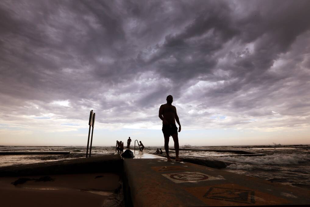
After a record-breaking hot summer, the region is in for a drenching this week – making for a soggy end to the season and a wet start to autumn.
Subscribe now for unlimited access.
$0/
(min cost $0)
or signup to continue reading
Rainfall totals of up to 200 millimetres are possible in parts of the region over the next eight days, with widespread falls of 100 to 150mm forecast.
The wet weather is the result of a slow-moving high pressure system in the southern Tasman Sea, with a trough off the NSW coast, which is expected to linger for much of the week.
The system is being helped by a surge of cooling air in the upper atmosphere and warmer than normal sea surface temperatures, according to Weatherzone.
“On top of that [high pressure system] there’s an onshore wind flow directing moisture towards the coast,” Weatherzone meteorologist Graeme Brittain said.
“So, anywhere along the coast of NSW is going to receive rainfall throughout this week. West of the ranges, however, will remain drier.”
This week’s Bureau of Meteorology forecast for Wollongong suggests a high chance of showers and the chance of a thunderstorm every day until Sunday.

At this stage, it appears the heaviest falls in the city will come later in the week.
The bureau’s data indicates possible totals of 15 to 40 millimetres in Wollongong on Thursday, 10 to 30mm on Friday and 8 to 25mm on Saturday.
Weatherzone modelling provides similar indications – 10 to 20 millimetres on Thursday, 20 to 40mm on Friday and 20 to 40mm on Saturday.

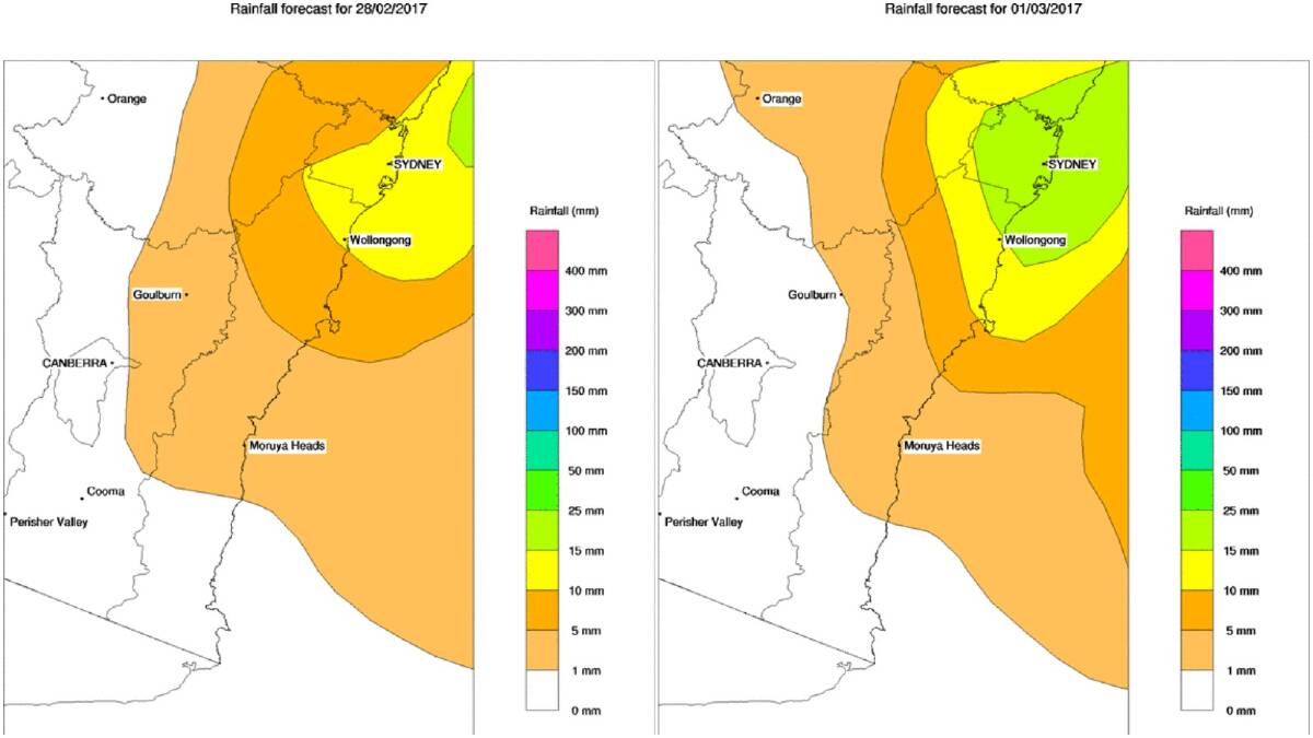
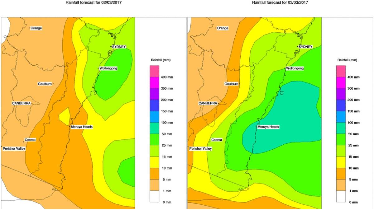
(Scroll down to see the predicted totals in your area)
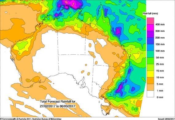
Accumulated rainfall mapping shows large totals across the Illawarra and South Coast between Monday and March 6 – most areas will pick up at least 100 to 150 millimetres during that period, the bureau says, although some locations could see eight-day totals of up to 200mm.
The week-long wet will come on top of above-average rainfall totals already being experienced in parts of the Illawarra during February.

Albion Park has recorded 240.2mm so far this month, largely thanks to a 24-hour fall of 112mm to 9am on February 8 and the 70mm that was tipped out of the gauge over the weekend.
The inland suburb’s average February rainfall total is 147.7mm.
A WEEK OF RAIN
WOLLONGONG
- Monday – 80% chance of 5 to 10mm
- Tuesday – 90% chance of 10 to 20mm
- Wednesday – 90% chance of 10 to 20mm
- Thursday – 90% chance of 10 to 20mm
- Friday – 90% chance of 20 to 40mm
- Saturday – 90% chance of 20 to 40mm
- Sunday – 90% chance of 5 to 10mm
ALBION PARK
- Monday – 80% chance of 5 to 10mm
- Tuesday – 90% chance of 5 to 10mm
- Wednesday – 90% chance of 10 to 20mm
- Thursday – 90% chance of 20 to 40mm
- Friday – 90% chance of 20 to 40mm
- Saturday – 90% chance of 40 to 80mm
- Sunday – 90% chance of 10 to 20mm
NOWRA
- Monday – 70% chance of 5 to 10mm
- Tuesday – 90% chance of 5 to 10mm
- Wednesday – 90% chance of 10 to 20mm
- Thursday – 90% chance of 10 to 20mm
- Friday – 90% chance of 20 to 40mm
- Saturday – 90% chance of 10 to 20mm
- Sunday – 90% chance of 1 to 5mm
ULLADULLA
- Monday – 70% chance of 1 to 5mm
- Tuesday – 90% chance of 1 to 5mm
- Wednesday – 90% chance of 5 to 10mm
- Thursday – 90% chance of 20 to 40mm
- Friday – 90% chance of 20 to 40mm
- Saturday – 90% chance of 20 to 40mm
- Sunday – 90% chance of 20 to 40mm
BATEMANS BAY
- Monday – 70% chance of 1 to 5mm
- Tuesday – 60% chance of 1 to 5mm
- Wednesday – 60% chance of 1 to 5mm
- Thursday – 90% chance of 20 to 40mm
- Friday – 90% chance of 20 to 40mm
- Saturday – 80% chance of 10 to 20mm
- Sunday – 90% chance of 40 to 80mm
BEGA
- Monday – 70% chance of <1mm
- Tuesday – 60% chance of <1mm
- Wednesday – 60% chance of 1 to 5mm
- Thursday – 90% chance of 20 to 40mm
- Friday – 80% chance of 20 to 40mm
- Saturday – 80% chance of 5 to 10mm
- Sunday – 90% chance of 10 to 20mm
EDEN
- Monday – 70% chance of 1 to 5mm
- Tuesday – 60% chance of <1mm
- Wednesday – 70% chance of 1 to 5mm
- Thursday – 90% chance of 10 to 20mm
- Friday – 90% chance of 20 to 40mm
- Saturday – 80% chance of 20 to 40mm
- Sunday – 90% chance of 10 to 20mm
*Source: Weatherzone


